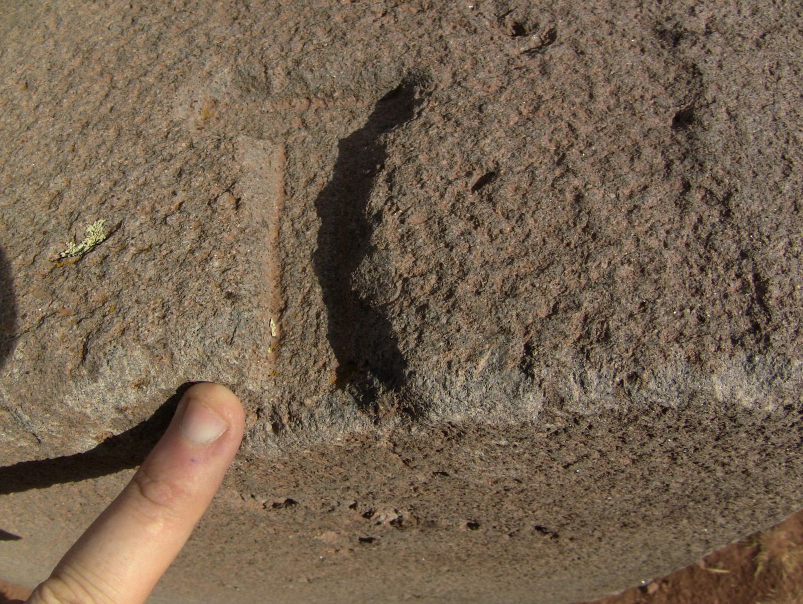
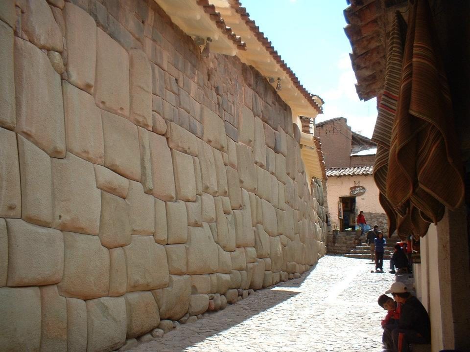
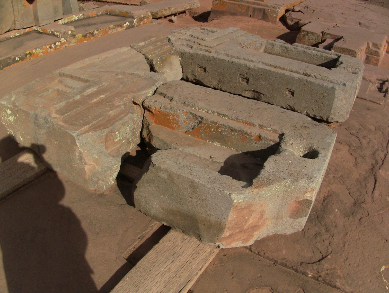
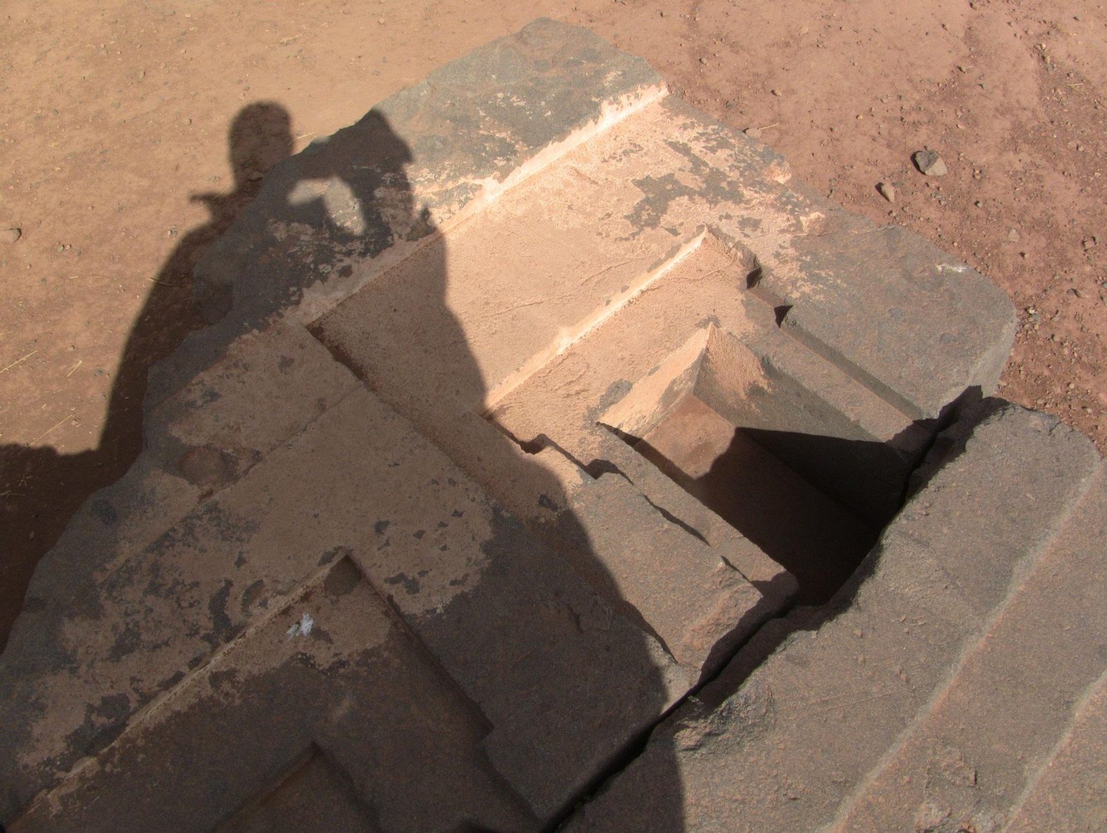
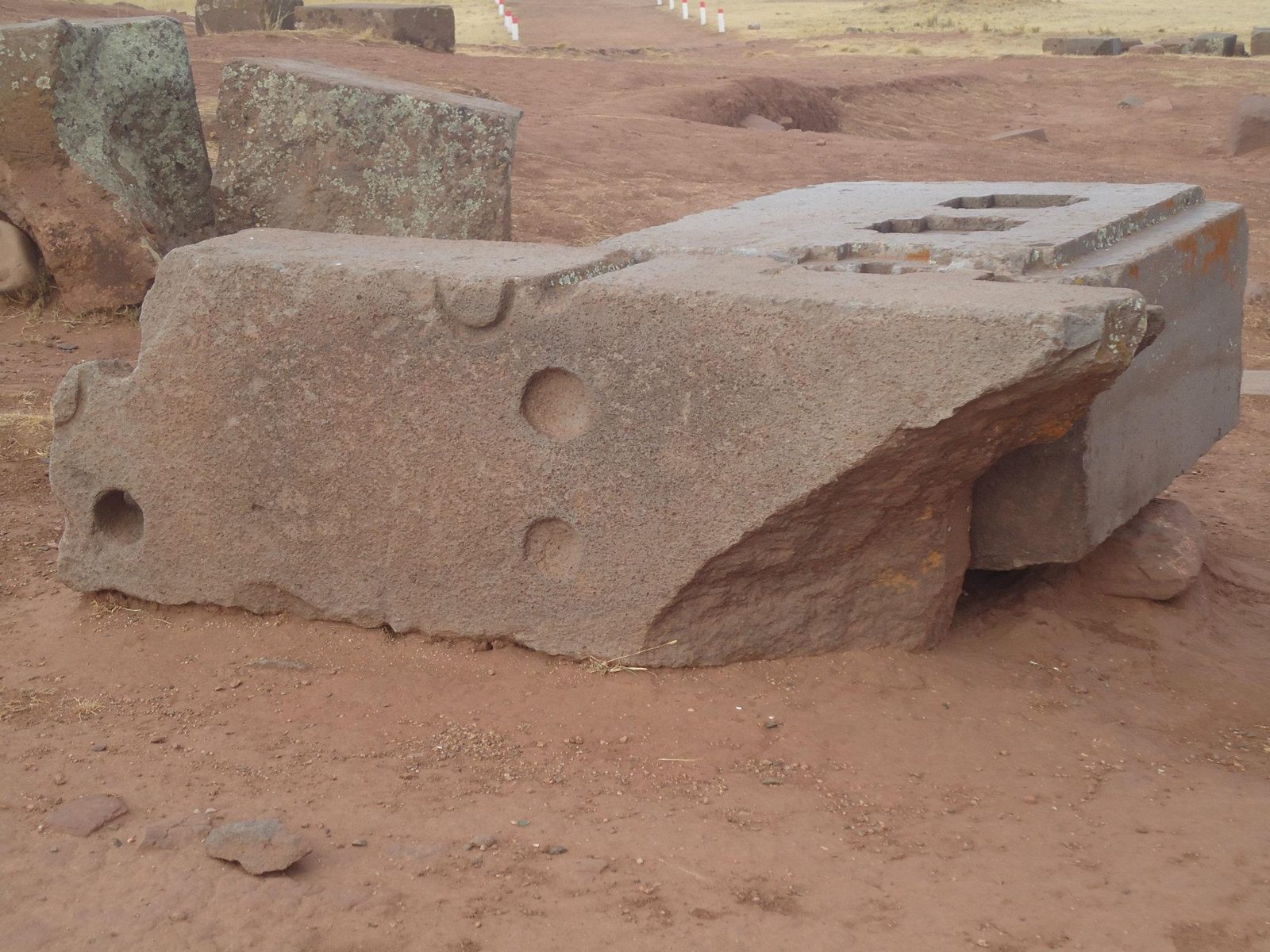
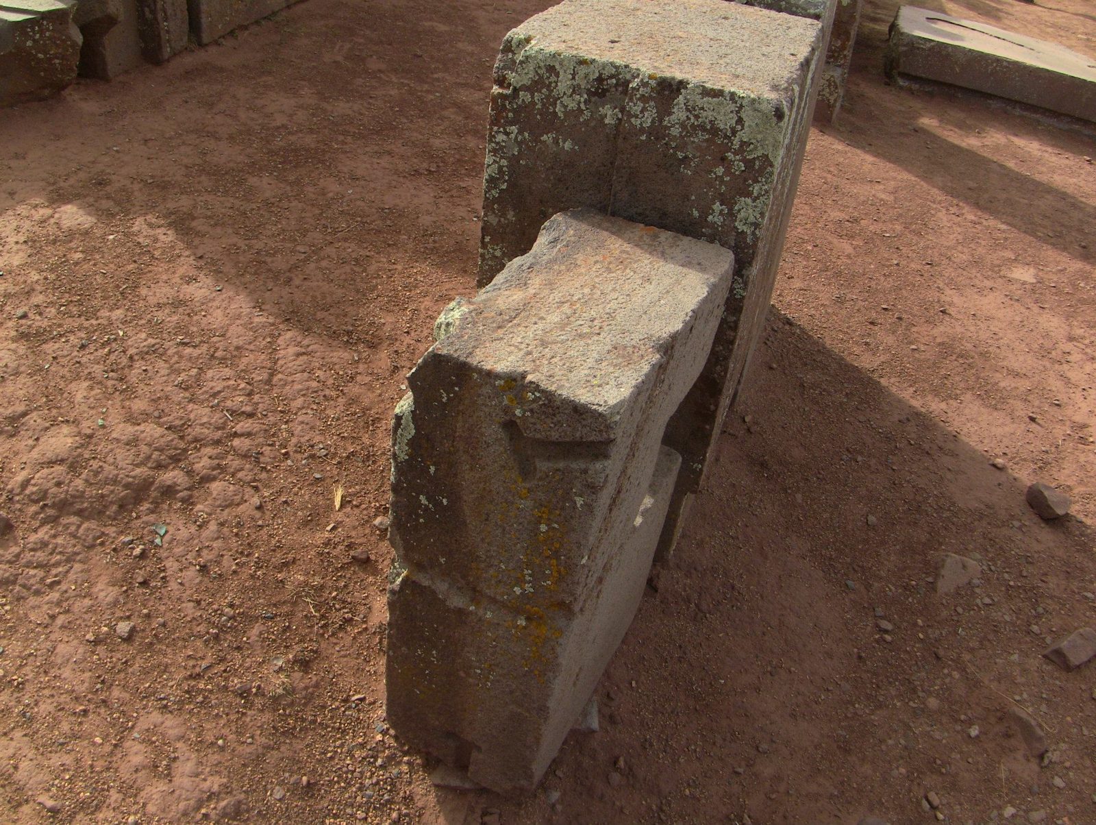
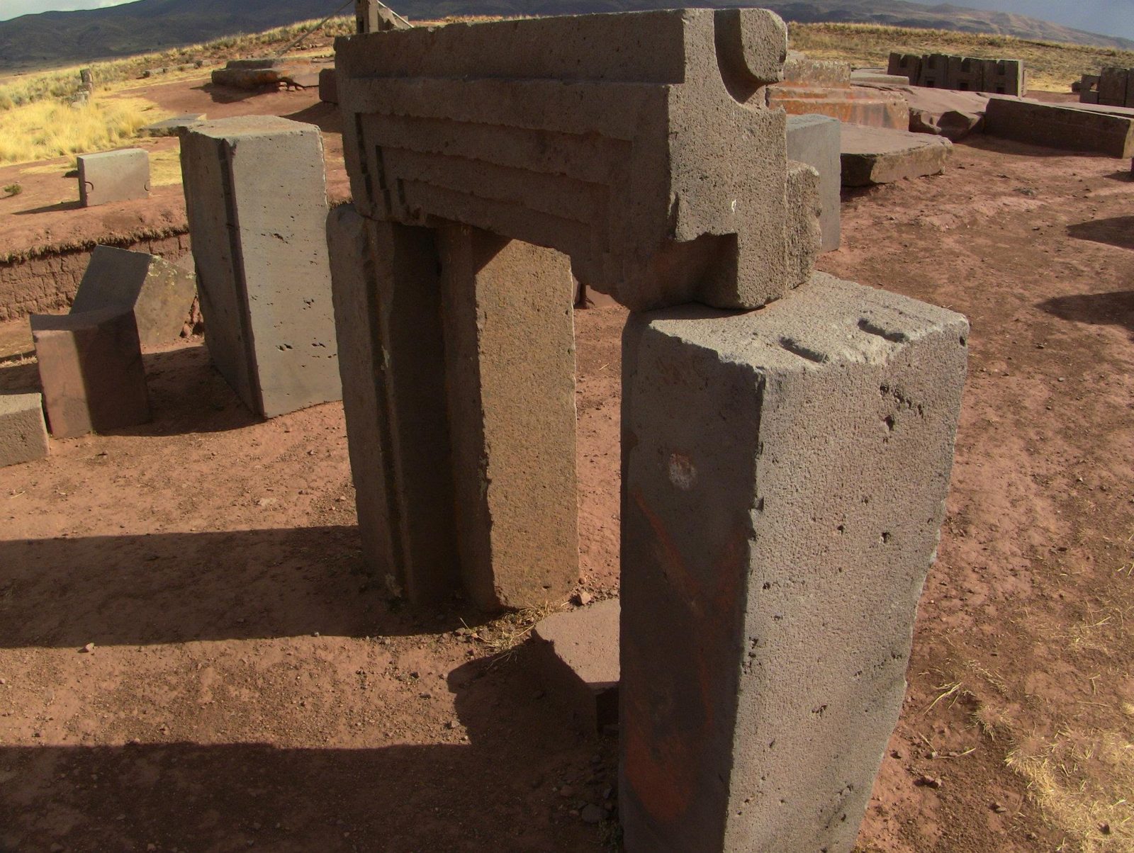
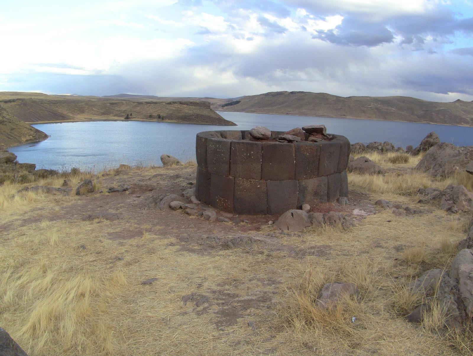
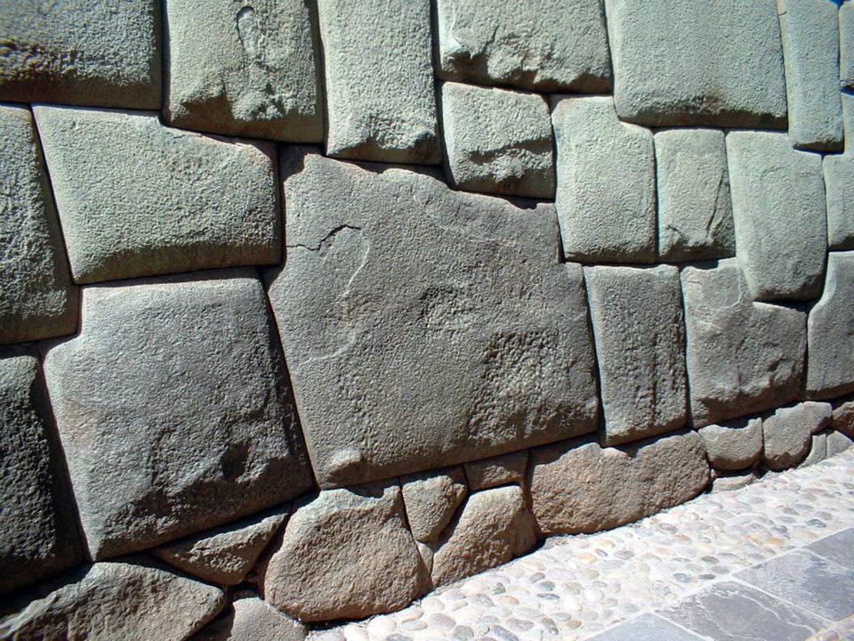
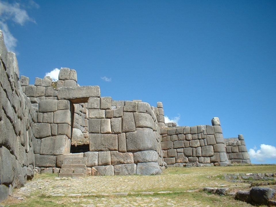
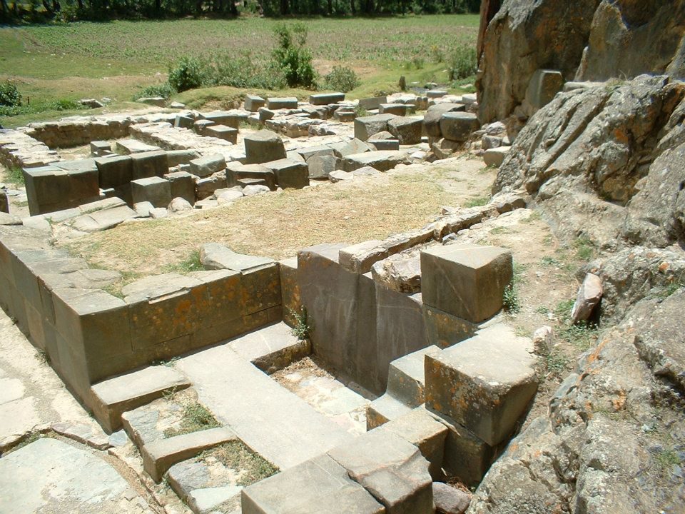
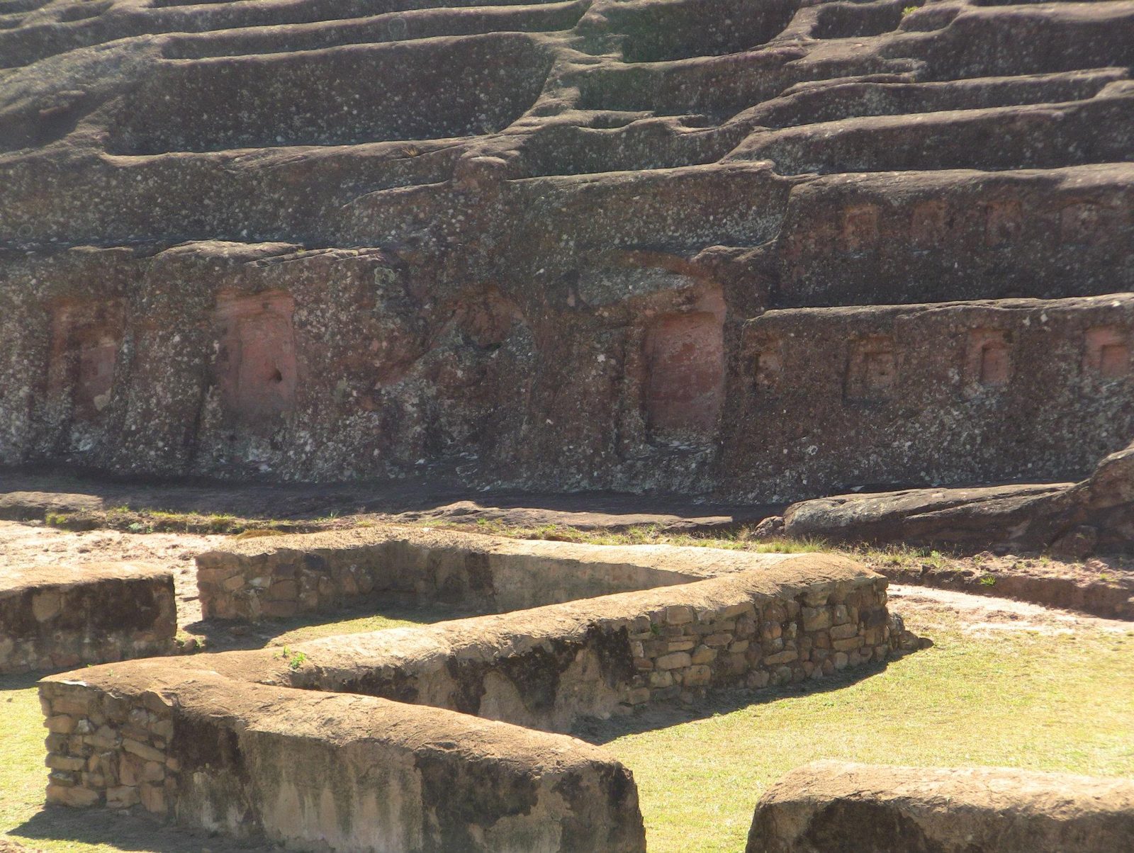
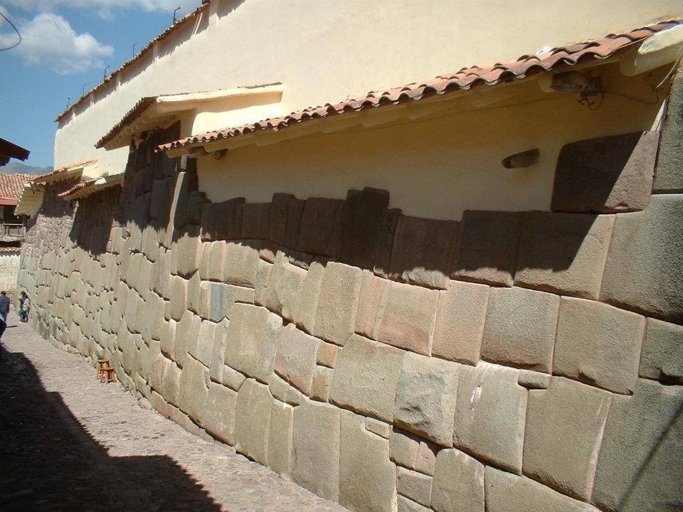
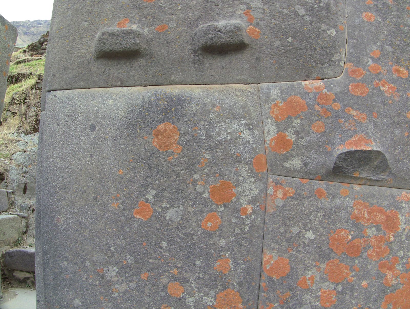
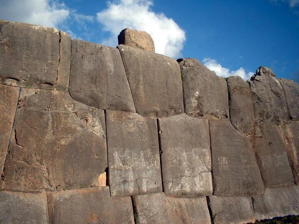
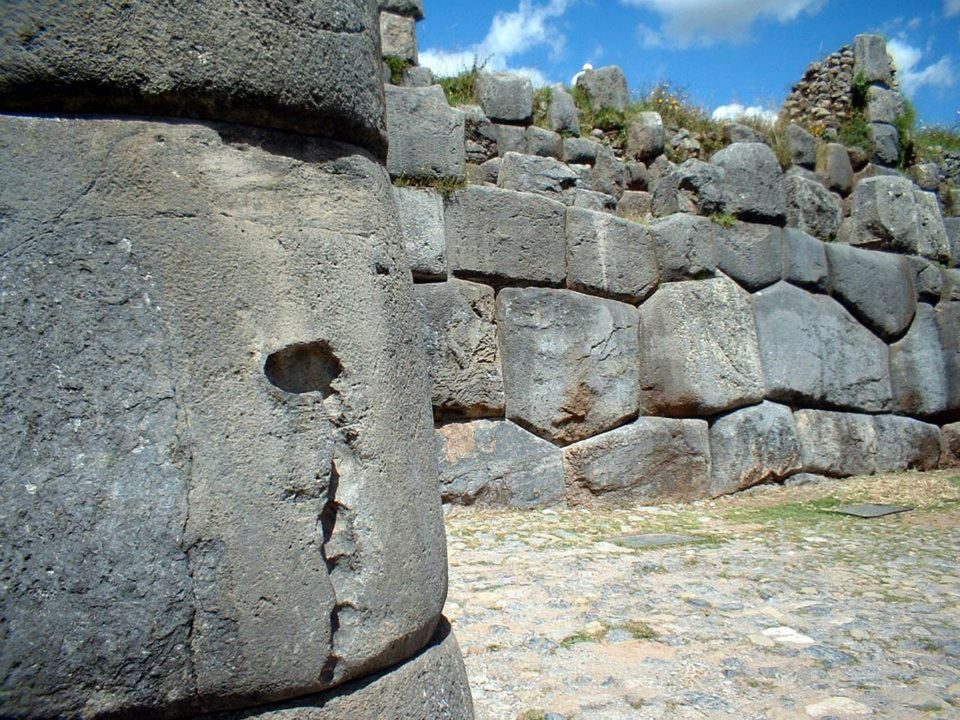
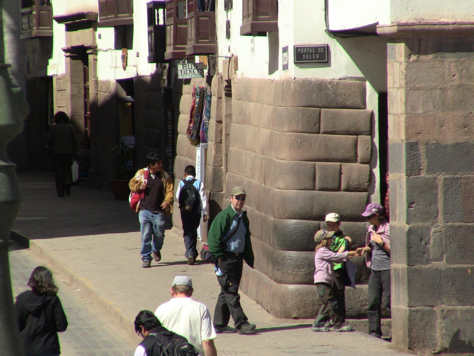
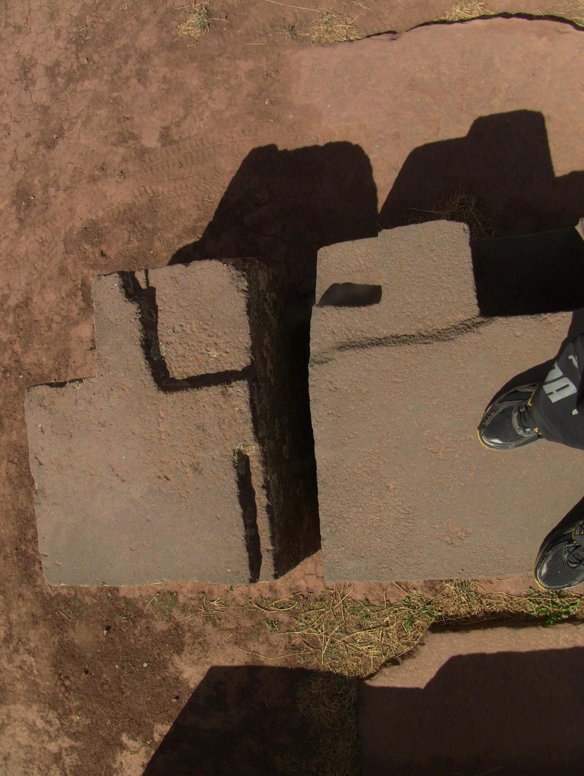
At Puma Punku a fingertip gives the scale of an inner corner carved into the stone. In Cusco the eye catches on a joint: it turns many times, and the edge of the next stone follows every turn. In 1549 Cieza de León heard at Tiwanaku that the Inca took these ruins as the model for the walls of Cusco. Sixty years later Garcilaso, of Inca descent, wrote the opposite: an Inca master built Tiwanaku. Radiocarbon places the building of Puma Punku at about AD 580–710, centuries before the Inca empire. Which story holds up when the stones are compared?
How the notes are marked
T
Research finding
A
Chronicle or other document
L
Legend
H
Researcher's hypothesis
S
Speculation
K
Illustrator's interpretation
The photos are from 2011. Background information concerns the site, not always the exact stone in the photo.
The plain and the lakeTiwanaku, Puma Punku, Sillustani: stone older than the Inca, and the towers of the Qolla.
The Inca heartlandCusco, Sacsayhuamán, Ollantaytambo: a copy, a workforce, and a building site left unfinished.
Rock and lightMachu Picchu, the Torreón, Samaipata: from a building to a carved mountain.
The last layerA colonial wall on top of an Inca wall in Cusco.
I Tiwanaku: the oldest layer
In 1549 a Spaniard asked whether the Inca had built this. The local people laughed at the question.
A Cieza de León passed through Tiwanaku in 1549. In his chronicle he says he asked whether the buildings were made in Inca times. The local people laughed and said the ruins were older than the Inca. L They had heard from their fathers that everything appeared, finished, in a single night. A In the same chapter Cieza says he had heard that the Inca made the great buildings of Cusco on the model of this wall (Cieza 1553, chapter CV).
T Radiocarbon dates place the founding of Tiwanaku around AD 180. Its largest monuments were built mainly in the 7th century (Marsh et al. 2023). T In June 2025 researchers published the Palaspata temple, 215 km south-east of Tiwanaku. It measures about 125 × 145 metres, with 15 enclosures around a courtyard. It shows how far Tiwanaku's reach extended (Capriles et al. 2025).
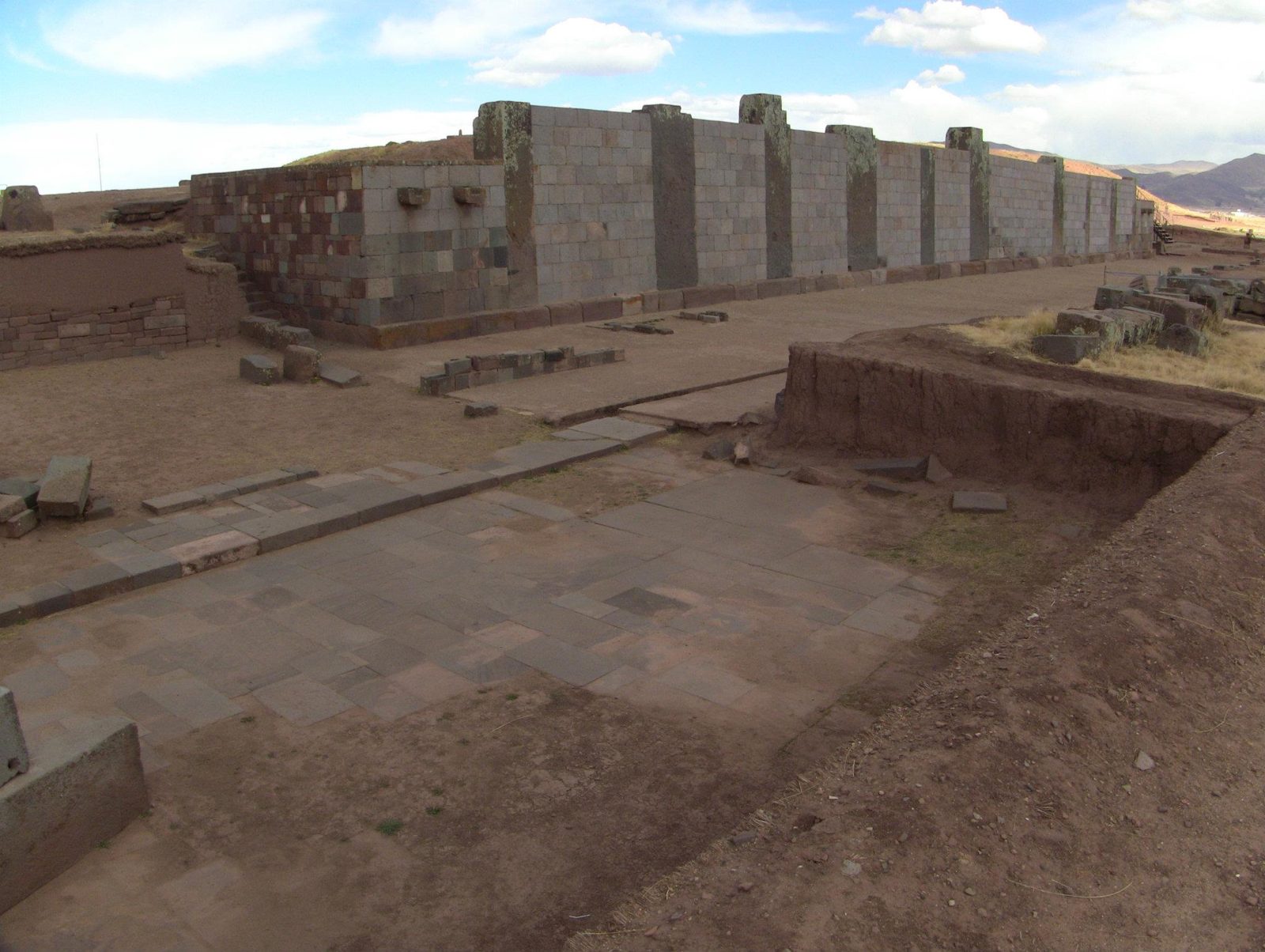
T In the Kalasasaya courtyard stand the Ponce and Fraile monoliths. The Bennett monolith was found in the semi-subterranean temple and is now in the site's stone museum (Tiwanaku site description). Ponce and Bennett hold a kero cup and a snuff tablet. H Villanueva Criales reads them as mountains, or stone taken from a mountain, rather than as portraits of people (Villanueva Criales 2024). T Much of the infill wall between the pillars is the result of a reconstruction that began in the late 1950s.
Tiwanaku & Puma Punku: The Kalasasaya wall. The upright pillars and the infill wall between them stand apart in the photo. Much of the infill is the result of a reconstruction that began in the late 1950s.
At the edge of the plain lies Puma Punku. It too has been reassembled: in 2006 its sandstone platforms were levelled and blocks were moved, some into the wrong places (Vranich 2018). The 2011 photos show one stage in the site's history.
II Puma Punku: standardised precision
A fingertip gives the scale. The same sharp inner corner repeats from block to block.
T Puma Punku is a building of the Tiwanaku period, not of the Inca. Marsh et al. modelled all 102 radiocarbon dates from Tiwanaku. At Puma Punku, five dates from above and below two differently coloured surfaces refine the building sequence. In the model, construction began around AD 580, quarried and carved stones were last used around 630, and building ended around 710. The authors suggest the work may have been in the hands of only one or two generations of masons (Marsh et al. 2023).
T The red sandstone was quarried closer, in the mountains south of Tiwanaku. The grey andesite came from the southern shore of Lake Titicaca, possibly from Kapia volcano or the Copacabana peninsula (Villanueva Criales 2024). A metal cramp about 19 cm long is still in place in the wall of the south canal. It was poured molten into sockets cut into two neighbouring blocks, and the metal is an alloy of copper, arsenic and nickel (Lechtman 1996).
H Vranich turned historical measurements into 3D prints at 4 per cent scale and tested how the scattered pieces fit together. The result is a reasoned reconstruction, not proof of the original layout (Vranich 2018).
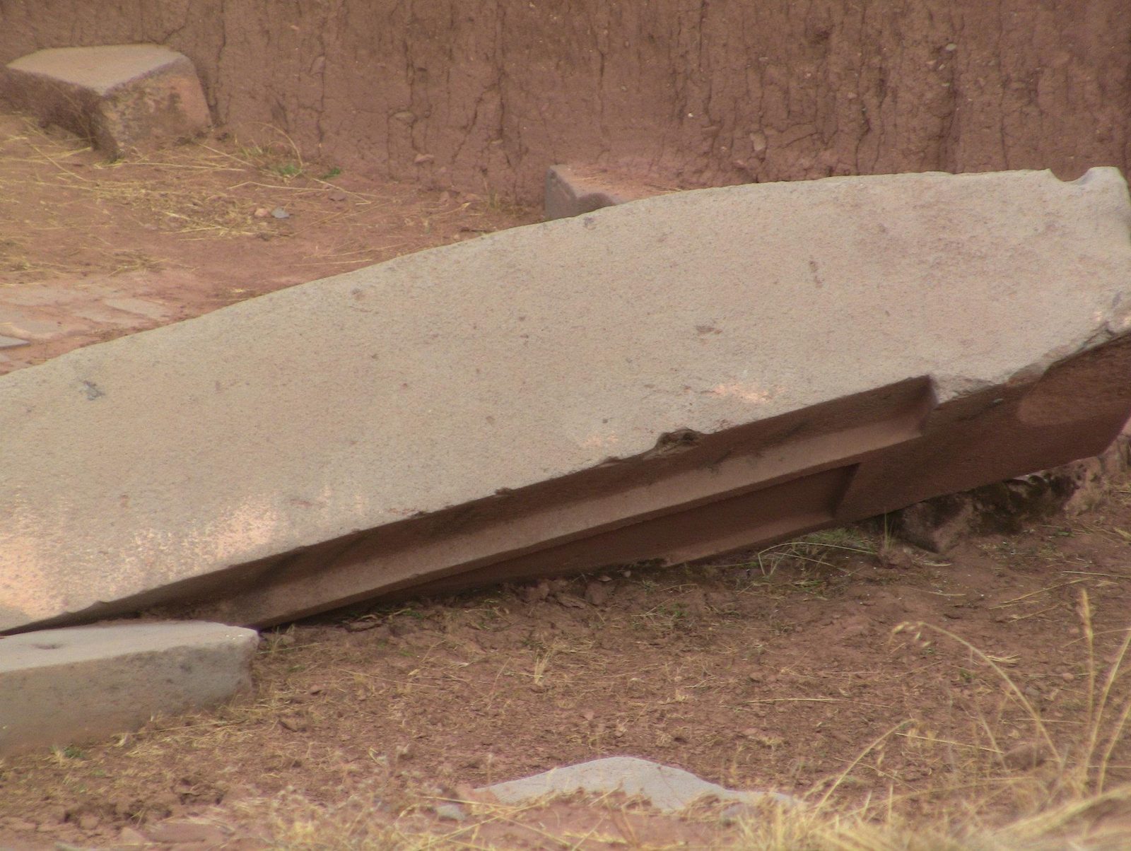
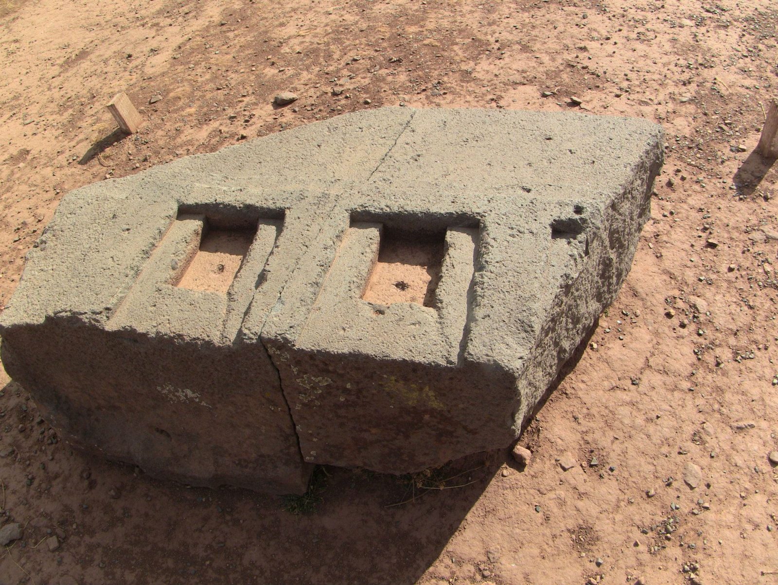
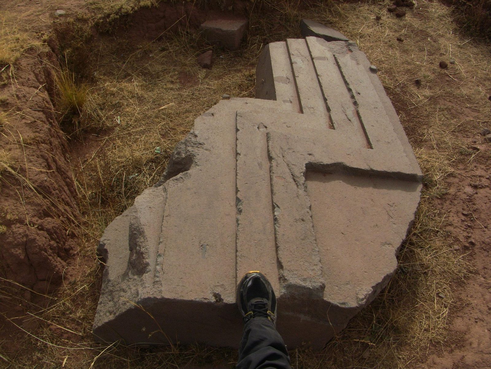
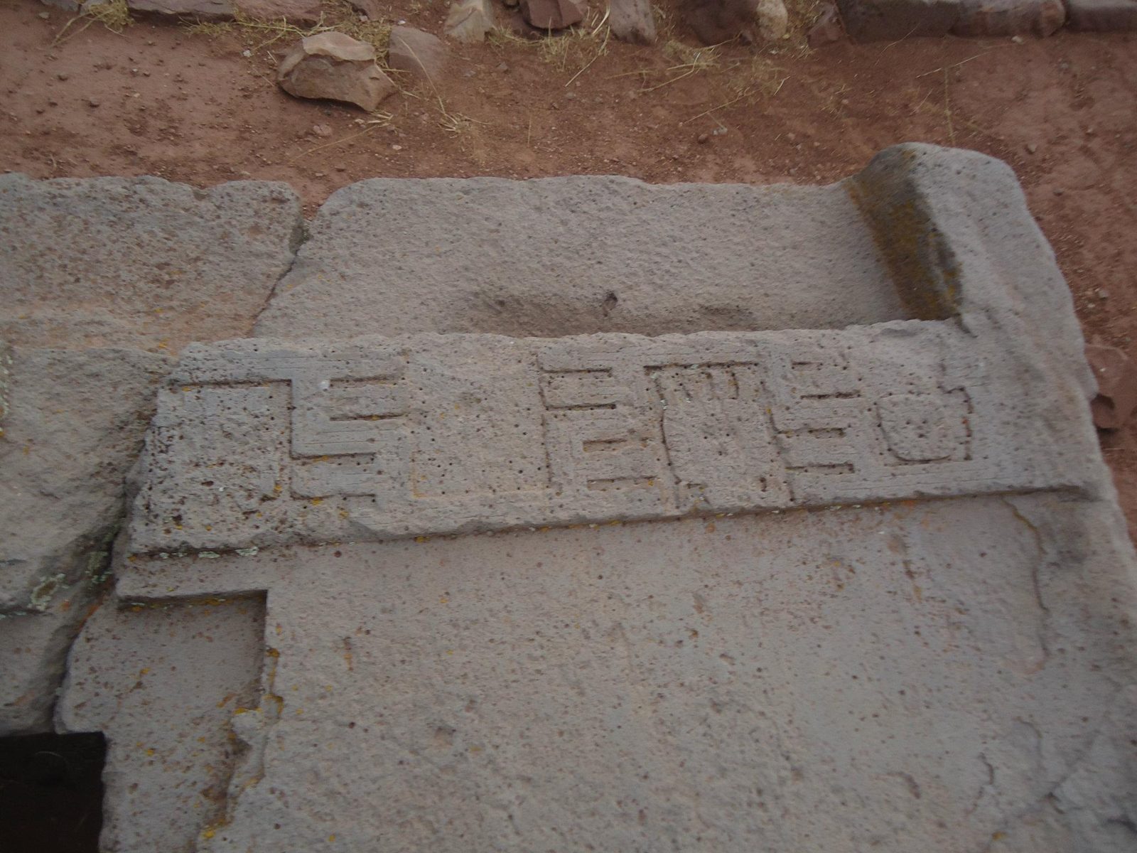
Tiwanaku & Puma Punku: A finger gives the scale of the sharp inner corner. Which tools made corners like this is still an open question.Tiwanaku & Puma Punku: A long sandstone slab. Vranich (2018) gives the largest slab as 8.12 × 3.86 × 1.2 m and estimates its weight at about 83 tonnes. This slab may not be the largest.Tiwanaku & Puma Punku: H-blocks. The same shape repeats from block to block.Tiwanaku & Puma Punku: A stepped recess. The shape was planned before the carving.Tiwanaku & Puma Punku: Precisely cut recesses and round holes. Their purpose is still debated.Tiwanaku & Puma Punku: Stone locks into stone by its shape.Tiwanaku & Puma Punku: A small gateway set up again: two jambs and a separate lintel.
At Tiwanaku the same part repeats. On the other side of Titicaca, stone becomes a house for the dead.
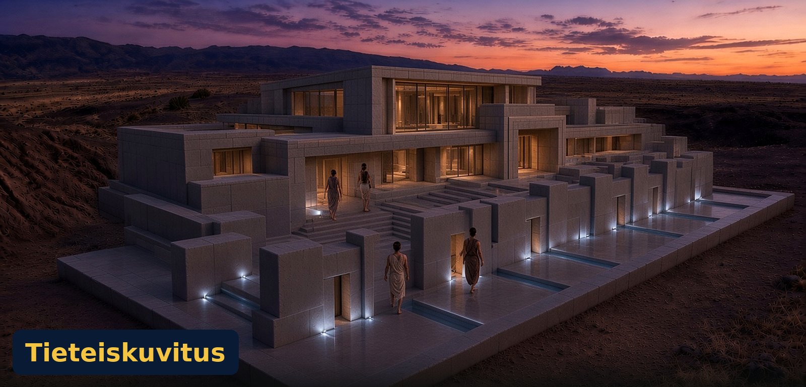
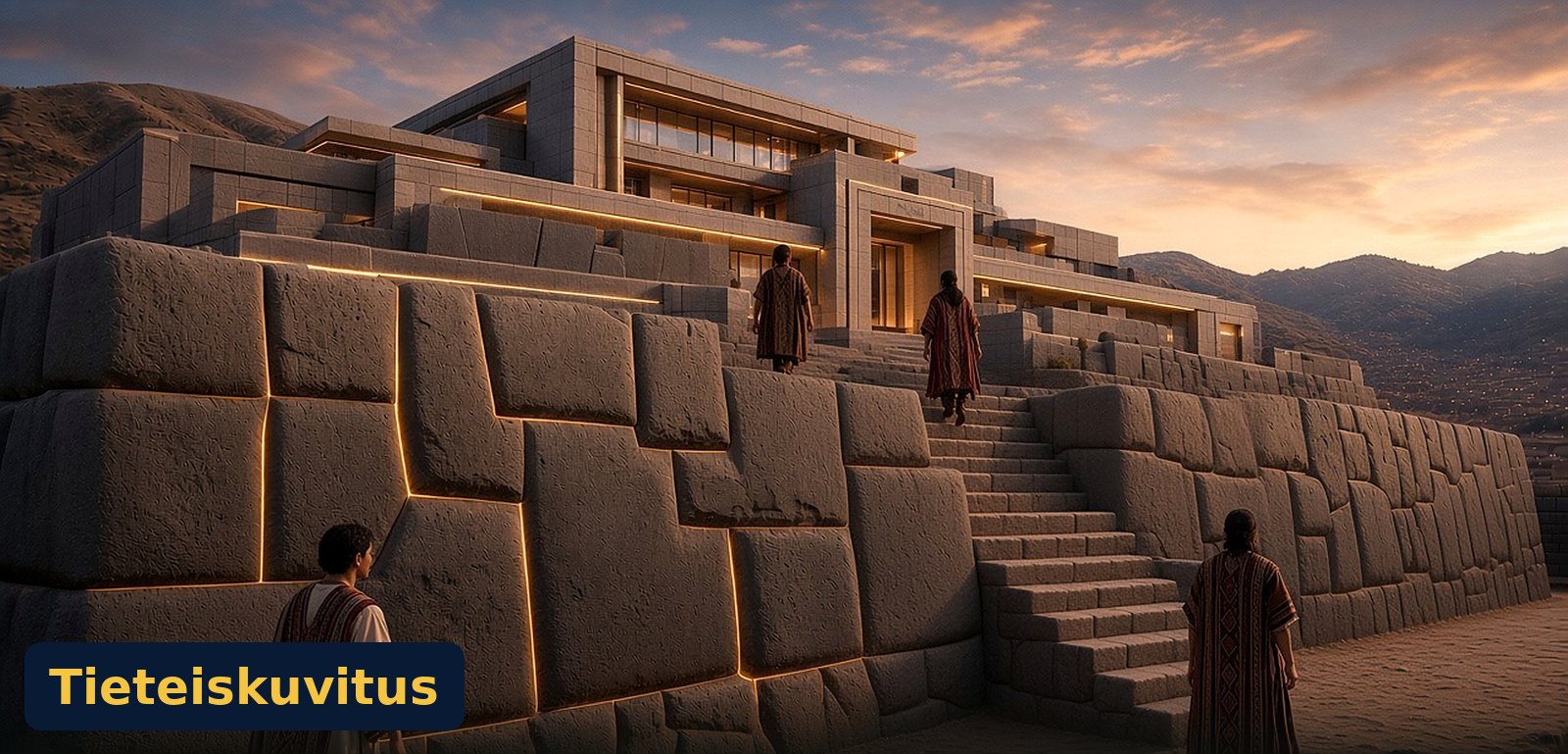
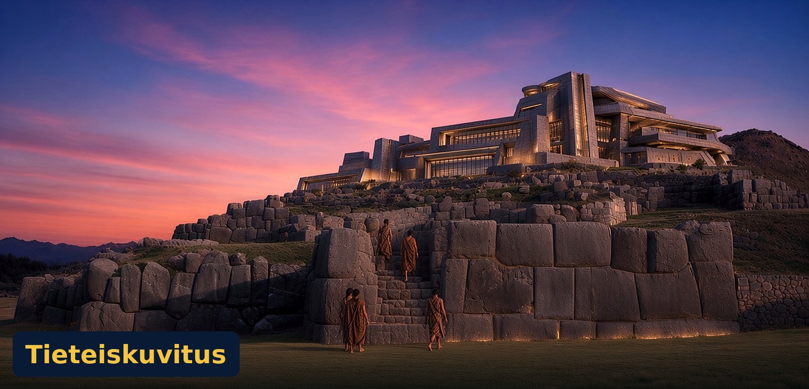
Hypothesis image · science fiction illustrationS Puma Punku imagined as the work site of a different, technically more advanced civilisation. The image illustrates a hypothesis and is not based on research. The research-based account is in the text of this chapter.
III Sillustani: an inheritance by the lake
Here the dead were not buried underground. Towers were built for them above the lake.
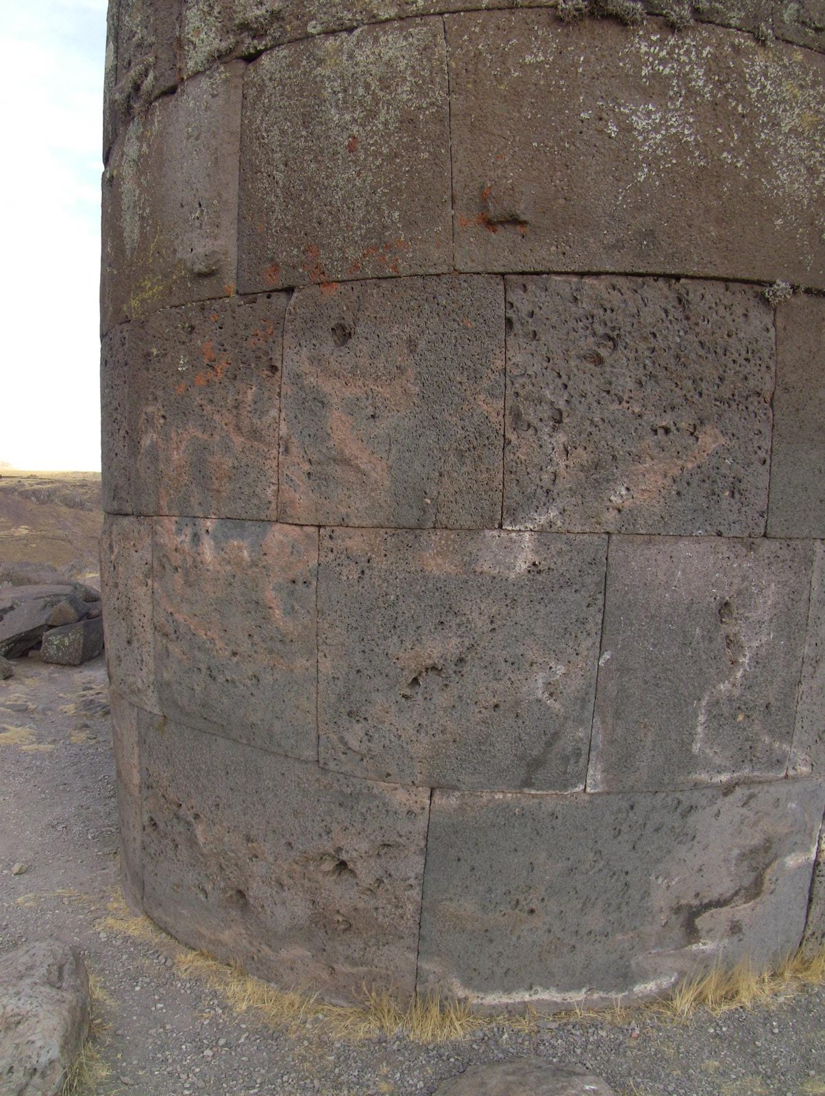
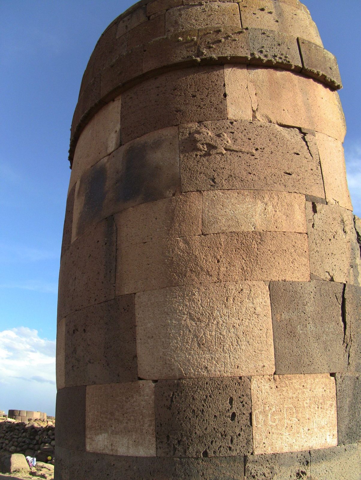
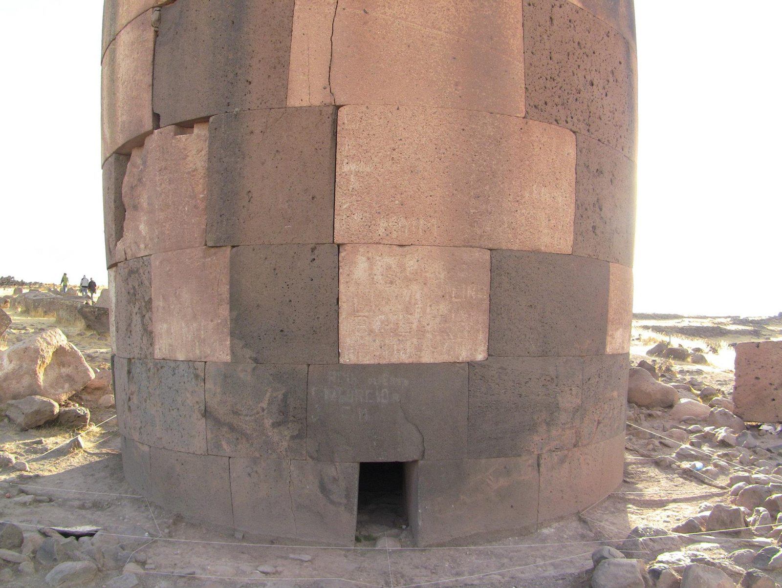
T On a peninsula of Lake Umayo stand 91 tomb towers, or chullpas. The Qolla began building them in the 13th century, before the Inca. The tallest, the Chullpa del Lagarto, is 12 metres high (Peru tourism inventory). Under the Inca, old towers were faced with blocks cut to the curve.
A In Bertonio's Aymara dictionary (1612) amaya means a dead body. A house-like tomb built above ground is amaya uta, "house of the dead" (Bertonio 1612).
T In 1971 gold, silver and copper objects, spondylus shell and beads were excavated near the Chullpa del Lagarto, including 502 pieces of gold. Bolívar links the find to the Qolla period (Bolívar 2003). The find is not from the towers in these photos.
Sillustani: Joints fitted to the curve. The outer face of each block is cut to the curve of the tower.Sillustani: Red and grey stone. The top of the tower has a projecting rim.Sillustani: A low round base, two courses high, by the lake. The photo cannot show whether the tower was left unfinished or taken down.
The Inca did not tear down the Qolla towers. They faced them with their own stonework. What does an Inca wall look like in their own capital?
IV Cusco: did the Inca copy?
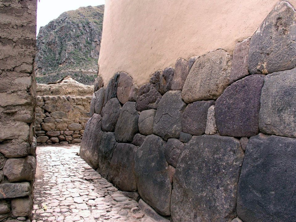
If the Inca copied Tiwanaku, this alley should look like Puma Punku. Does it?
T Protzen and Nair compared Tiwanaku and Inca masonry, and the joint structures did not match (Protzen and Nair 1997). In an Inca polygonal wall each stone is fitted to its neighbours one by one. There are no standard parts.
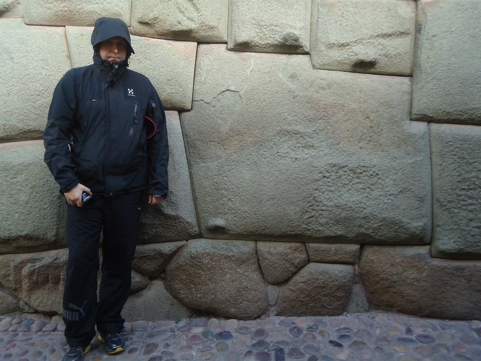
A The twelve-angled stone on Hatun Rumiyoc street was originally part of the wall of Inca Roca's palace. The Smithsonian has a public 3D model of the wall (Smithsonian 3D).
T In March 2014 the letters "JHK" were sprayed on the stone over an area of about 50 × 40 cm (Panamericana 9 March 2014). On 18 February 2025 the stone was struck with a metal object. Six visible impact marks remained and fragments broke off (Ministry of Culture 18 February 2025). Jani's 2011 photo shows the stone before both incidents.
S The "puma" and "snake" that guides point out in the same wall are ways of seeing, not research findings.
Cusco: The twelve-angled stone on Hatun Rumiyoc street.Cusco: The same stone from another angle.Cusco: A polygonal alley wall. Cloth dries beside it and people sit in the shade.
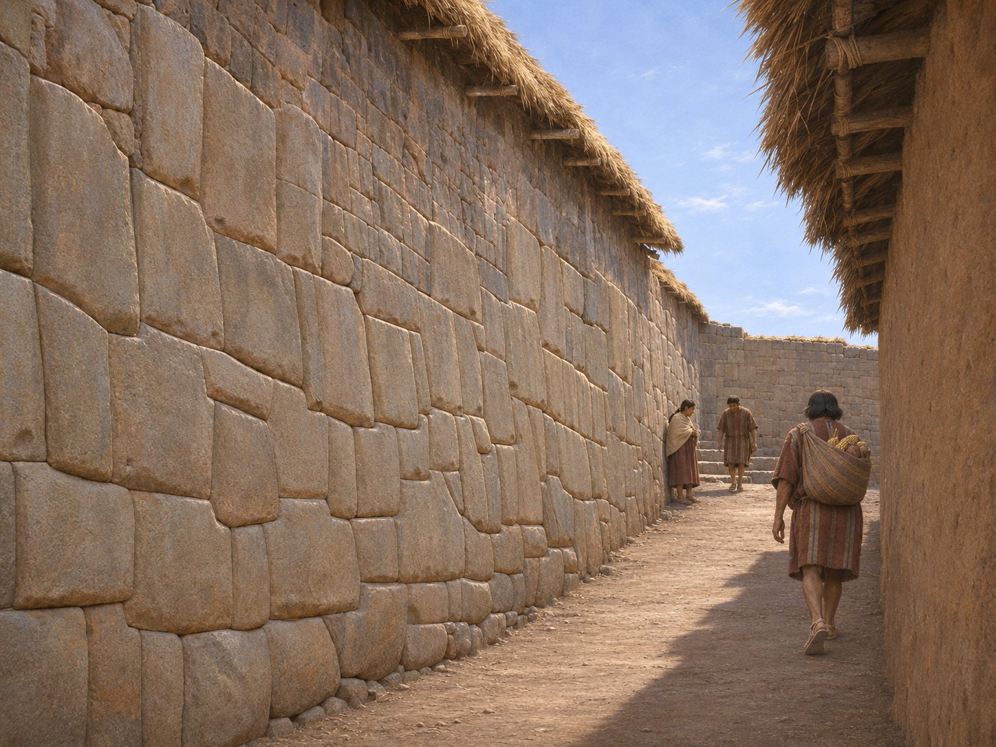
A Cusco alley in 2011 and around AD 1500
Photo 2011A polygonal alley wall in Cusco in 2011. At the end of the alley are steps and a plastered house. Photo: Jani Korpi.AI-assisted historical illustrationCusco, around AD 1500. A narrow passage follows a polygonal stone wall. The viewpoint and the proportions of the wall are based on Jani Korpi's travel photo. The walkers, their loads and the upper parts of the buildings are interpretation. The stone joints, the end of the alley and the roof heights differ from the photo. AI-assisted historical illustration.
The joints are not a copy of Tiwanaku. Even so, the Inca knew Tiwanaku. What did they themselves say about it?
Hypothesis image · science fiction illustrationS The Hatun Rumiyoc stone imagined as the work site of a different, technically more advanced civilisation. The image illustrates a hypothesis and is not based on research. The research-based account is in the text of this chapter.
V Sacsayhuamán: labour and memory
The first Spaniards compared this to the buildings of Rome. Garcilaso, of Inca descent, gave Tiwanaku to an Inca master.
A Pizarro's secretary Pedro Sancho wrote in 1534 that, according to the Spaniards, neither the Roman aqueduct of Segovia nor any building of Hercules or the Romans was as worth seeing. The text survives only in Ramusio's Italian translation, first published in 1556 (Ramusio 1556).
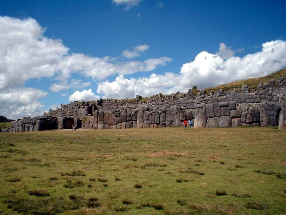
A Cieza de León recorded a workforce of 20,000 men: 4,000 quarried and broke the stones, 6,000 hauled them with ropes of leather and fibre. In the same chapter he says the local people called the place the House of the Sun and the Spaniards called it the fortress. This second part of his chronicle was not printed until 1880 (Cieza, El señorío de los Incas, chapter LI).
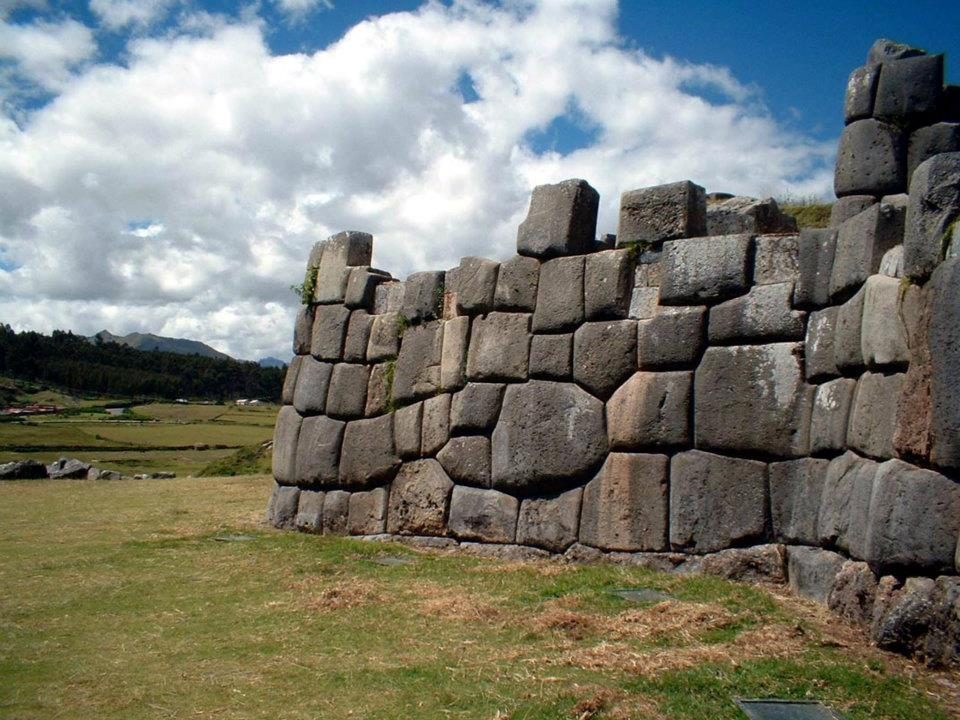
A Garcilaso de la Vega wrote in 1609 that four masters directed the work. The third, Acahuana Inca, was said to have built much of Tiahuanaco as well. L Garcilaso also tells of the tired stone that wept blood. He explains himself that the stone slipped on the slope and crushed thousands of the men hauling it (Garcilaso 1609, book VII, chapter XXIX).
T In 2024 six test pits were opened at Muyuqmarka, Cruzmoqo and the Baluartes area of the zigzag walls. The project is led by Sabino Quispe of the Cusco culture office and Alexei Vranich. At Cruzmoqo a pre-Inca Killke occupation was confirmed (El Búho 14 September 2024). In April 2026 the project reported mapping about 69 hectares with drone lidar, photogrammetry and ground-penetrating radar. Under the vegetation it found terraces, road networks, structures and possible quarries. No dates have been published (CNR ISPC 21 April 2026).
T At the Cruz Moqo sector, 138 scattered stones have been measured. The researchers tested whether the stones fit back together when their faces were turned into flat outlines. An outline loses depth: the stones taper inwards, they were set at different depths, and their faces lean by 3–5 degrees. That is why automatic matching remained uncertain. The study concerns Cruz Moqo, not the age of the zigzag walls (Reyes-Sevilla et al. 2026).
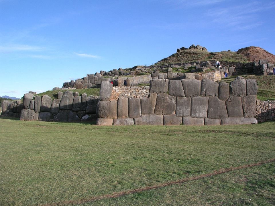
Sacsayhuaman: Look at the person in the photo and the height of the largest stones.Sacsayhuaman: A zigzag wall. According to Cieza, the local people called the place the House of the Sun.Sacsayhuaman: A corner of the wall. Garcilaso's four masters are known from a chronicle, not from excavation.Sacsayhuaman: A doorway in the wall.
Garcilaso's story is about memory and prestige. At Ollantaytambo there is one place where Tiwanaku influence has also been argued from the stones.
Hypothesis image · science fiction illustrationS The Sacsayhuamán wall imagined as the work site of a different, technically more advanced civilisation. The image illustrates a hypothesis and is not based on research. The research-based account is in the text of this chapter.
VI Ollantaytambo: a building site left unfinished
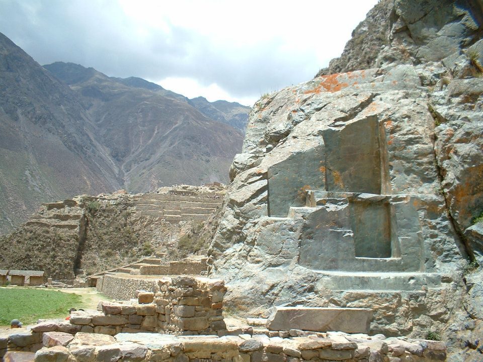
Here you can see what a finished wall hides: a building site left unfinished.
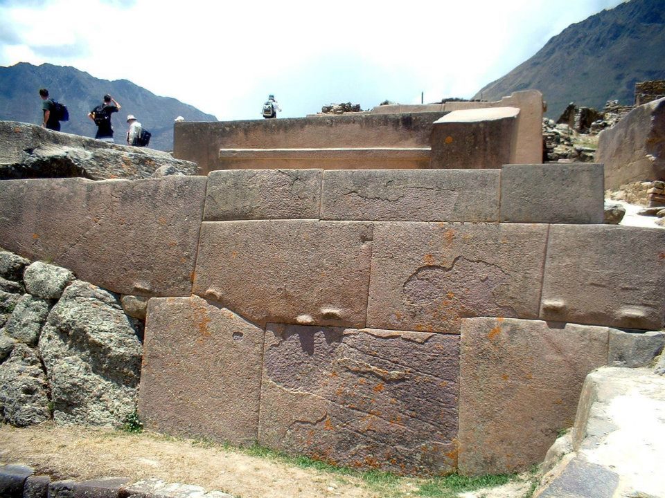
H The joints of the Wall of the Six Monoliths have T-shaped notches. Because of them, it has been suggested that masons of the Tiwanaku tradition built it. Protzen and Nair point out that here the notches have only one shape, while at Tiwanaku they have many (Protzen and Nair 1997).
T Irrigation in the valley continued after the empire fell. Hunter combines the sediments of the Pukaraqhay reservoir, dates and land survey records. In his account the canal system of about 15 km was maintained into the colonial period, until the system began to decay and the reservoir to silt up from around 1600 (Hunter 2025).
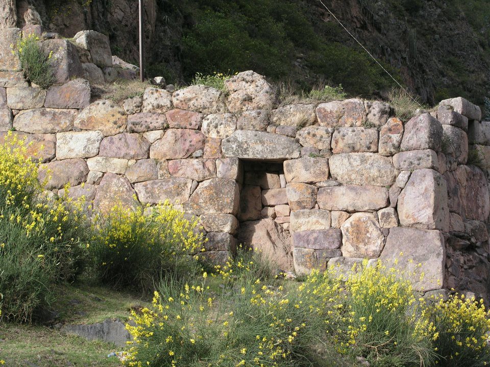
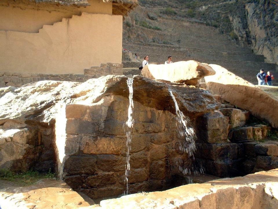
Ollantaytambo: Precisely fitted blocks. This may not be the Wall of the Six Monoliths.Ollantaytambo: A trapezoidal doorway.Ollantaytambo: Niches and terraces cut into the rock of Temple Hill.Ollantaytambo: A stone fountain where water still runs.Ollantaytambo: A village lane. The Inca street grid is still lived in.
The T-notches are the only place where direct influence has been argued, and even that is disputed. Further down the river is a ridge whose builders came from all over the empire.
VII Machu Picchu: an estate and its name
The world knows this place by a name its builders may not have used.
T AMS dates on human remains place its use at about 1420–1532. That is some twenty years earlier than the timeline derived from the chronicles (Burger et al. 2021). The dates come from bones and teeth and tell us when the site was used. The year any single wall was built remains open.
H Amado Gonzales and Bauer conclude from Bingham's notes, old maps and documents that the Inca most likely called the place Huayna Picchu (Amado Gonzales and Bauer 2021).
T Salazar et al. studied the genomes of 34 retainers buried at Machu Picchu. Their ancestry came from different parts of the empire, including the Amazon side (Salazar et al. 2023). The study does not tell who lived in which house.
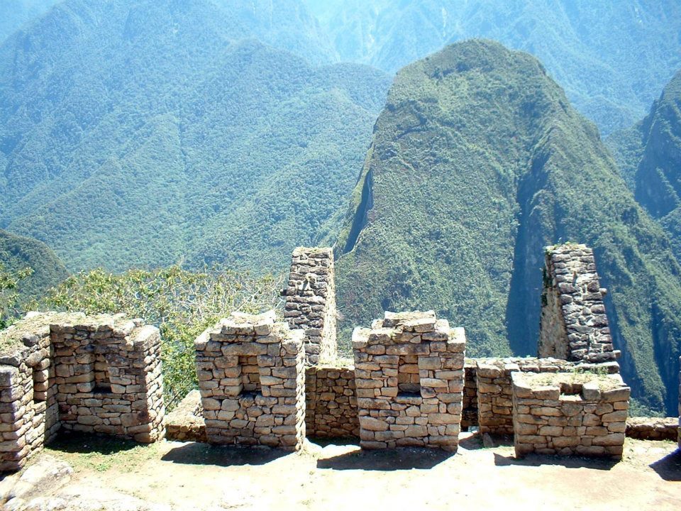
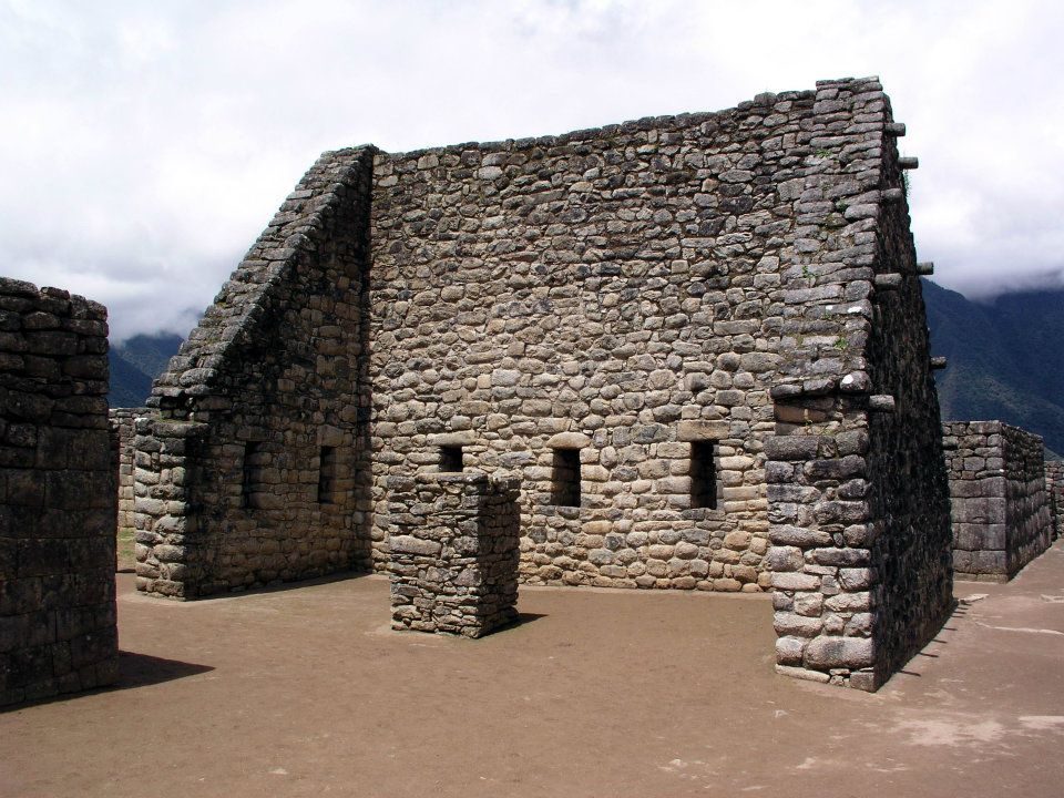
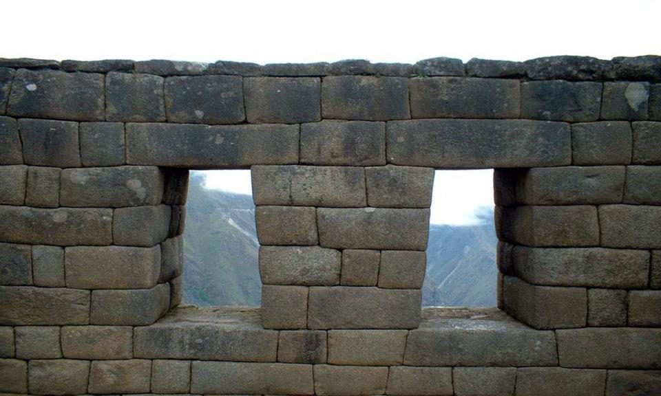
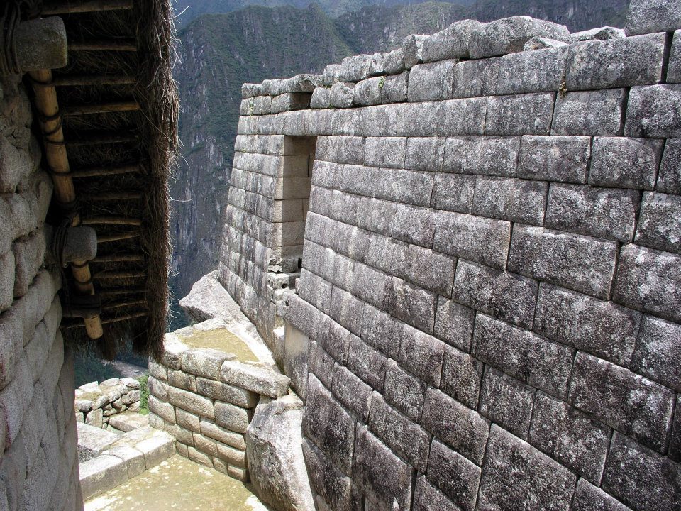
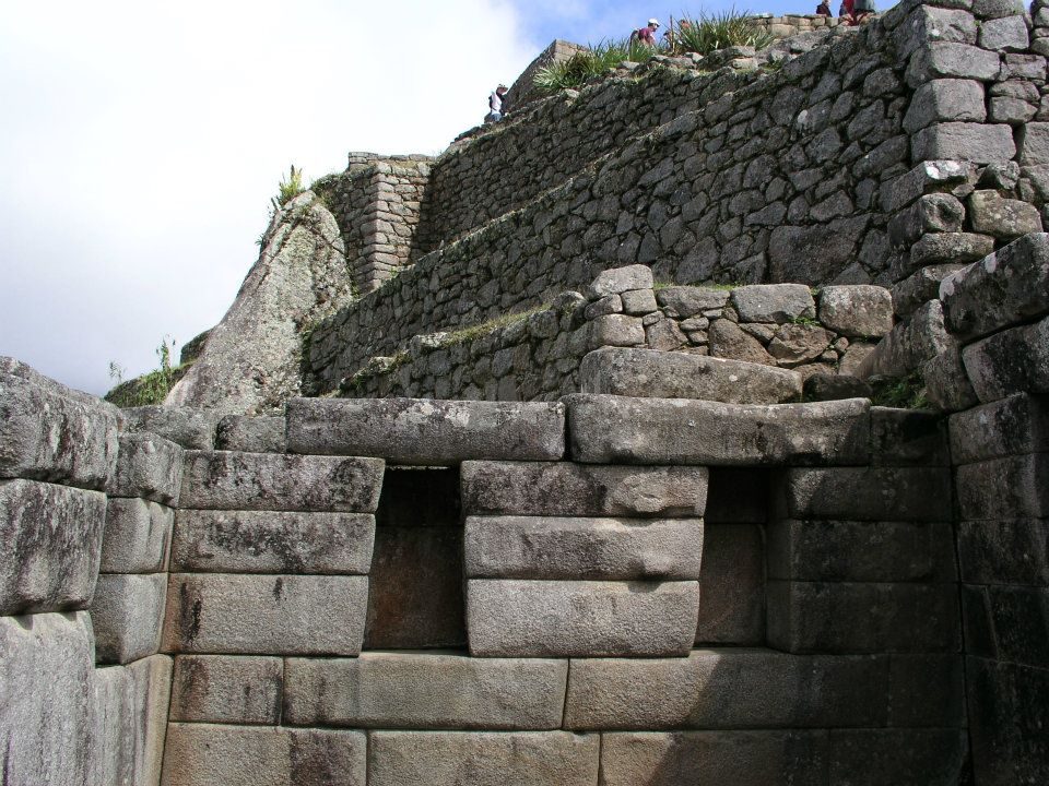
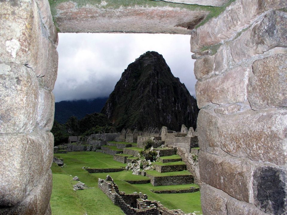
Machu Picchu: Buildings in front of Huayna Picchu.Machu Picchu: The gables still draw the shape of a house.Machu Picchu: Trapezoidal windows.Machu Picchu: A corner. Here the corners are rounded and the faces bulge. Compare the sharp corners of Puma Punku in chapter II.Machu Picchu: A terrace is a wall that holds up soil.
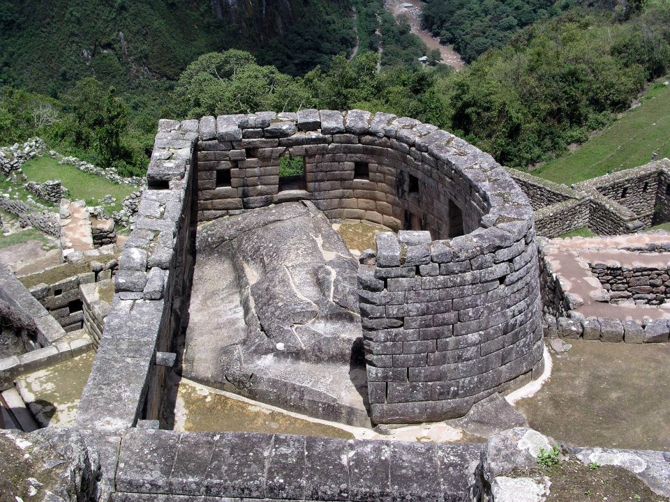
Then the wall curves and frames the morning light.
VIII The Torreón and the carved rock
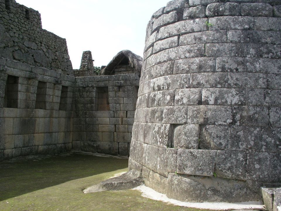
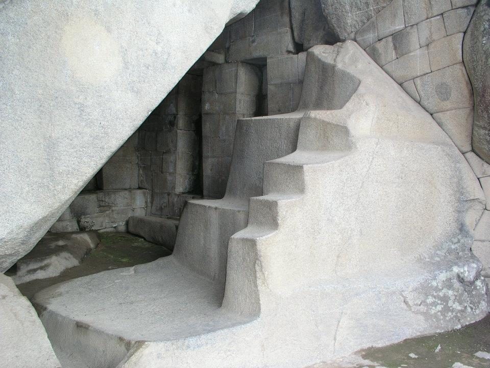
The wall is built on top of the natural rock. Beneath it is a cave.
T The builders of the Torreón oriented it to certain solar events. Kościuk and Ziółkowski studied the building with 3D survey data and conclude that it was not a precise astronomical observatory (Ziółkowski and Kościuk 2020).
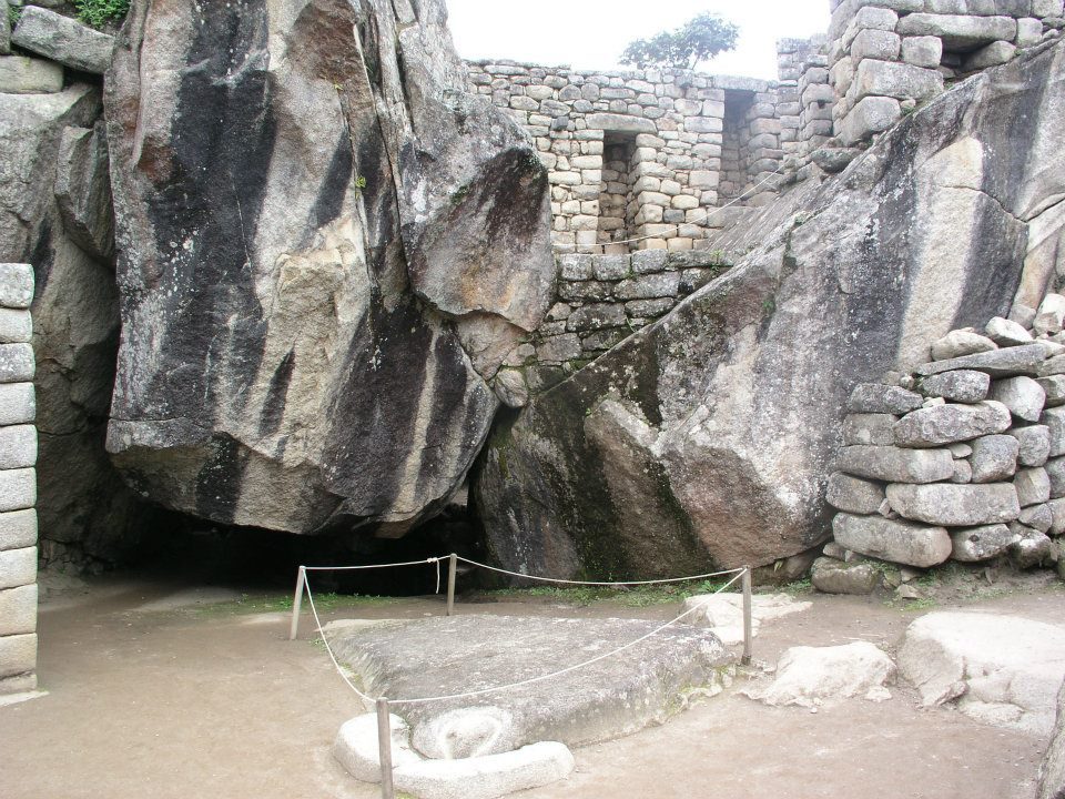
The Inca did not always lay stone in place. In the Temple of the Condor the rock itself is carved into part of the building.
Machu Picchu: The Torreón: a curved wall and a trapezoidal window.Machu Picchu: The cave beneath the Torreón, known as the Royal Tomb.Machu Picchu: The Temple of the Condor. The rocks suggest wings and the triangular stone in the floor a head. The name is modern.
The condor rock is carved, not laid. In the east, on the slopes of Bolivia, a whole mountain is like that.
IX Samaipata: the eastern edge
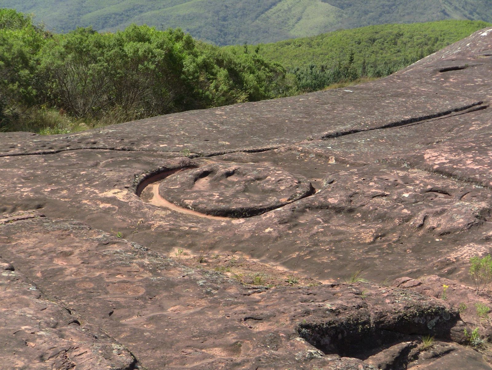
All along the route we have looked at joints. At Samaipata there are none: the rock itself is the sculpture.
T El Fuerte de Samaipata is a sandstone rock about 220 m long and 60 m wide, carved with animals, channels, niches and vessels. People of the Mojocoya culture began shaping the rock as early as about AD 300. The Inca took the site in the 14th century and made it a provincial capital. Remains of an Inca-period stone wall cut across several carvings, including the two parallel channels. So the carvings are older than the Inca (UNESCO).
S Erich von Däniken read the two parallel channels as launch ramps for spacecraft. Researchers regard them as carved channels, and the ramp idea has no archaeological support.
The Inca built next to and on top of an older carved rock. In the last chapter the same thing happens to the Inca themselves.
X Finale: the colonial layer of Cusco
The last photo asks the first question again: who builds on top of whom?
A The Spaniards built their churches and houses on top of Inca walls. UNESCO describes the city as an amalgam of the Inca capital and the colonial city (UNESCO).
T Combey et al. mapped almost 3,000 earthquake effects at nine Inca sites near Cusco. The results point to a previously unreported earthquake in Inca times, between about 1400 and 1533 (Combey et al. 2022).
A After the 1950 earthquake UNESCO sent an expert mission to Cusco in 1951. George Kubler's report dealt with the reconstruction of the town and the restoration of its monuments (Kubler 1952). The repairs of the 20th century are a layer of their own.
H In January 2025 researchers Jorge Calero Flores and Mildred Fernández Palomino said that ground-penetrating radar shows an underground passage between Qorikancha and Sacsayhuamán. In July 2025 its length was given as about 1,750 metres (Archaeology 16 January 2025, Andina 18 July 2025). No peer-reviewed publication exists, so this is a hypothesis.
Cusco: A sloping Inca wall with a plastered colonial wall on top.
The ruins of Tiwanaku were already old to the Inca. In Cusco, the Inca walls are now the lowest layer.
Conclusion of this page
The stones do not support either story as it stands. The builders of Tiwanaku had been dead for centuries before the walls of Cusco, and the joints are made differently: at Tiwanaku the same standard part repeats and joints are locked with metal cramps, while in an Inca wall each stone is fitted to its neighbours. Even so, the joints alone cannot tell who learned from whom. The Inca knew the ruins, and Garcilaso's story shows that they wanted them as part of their own history. The same happens in Cusco: the Spaniards built on top of the Inca walls, and the 20th century repaired both.
Cieza de León, Pedro de (1553). Parte primera de la Chrónica del Perú, chapter CV. Calpe edition 1922, Internet Archive. archive.org
Cieza de León, Pedro de (written in the 1550s, printed 1880). Segunda parte de la Crónica del Perú, que trata del señorío de los Incas, chapter LI. Internet Archive. archive.org
Garcilaso de la Vega, Inca (1609). Comentarios reales de los Incas, book VII, chapter XXIX. Museo Inka Garcilaso, PDF. museogarcilaso.culturacusco.gob.pe
Ramusio, Giovanni Battista (1556). Terzo volume delle navigationi et viaggi. Venice. Contains Pedro Sancho's account in Italian. Real Biblioteca Digital. rbdigital.realbiblioteca.es
Bertonio, Ludovico (1612). Vocabulario de la lengua aymara. Entries amaya and amaya uta. Internet Archive. archive.org
Marsh, E. J. et al. (2023). The center cannot hold: A Bayesian chronology for the collapse of Tiwanaku. PLOS ONE 18(11): e0288798. doi.org
Capriles, J. M. et al. (2025). Gateway to the east: the Palaspata temple and the south-eastern expansion of the Tiwanaku state. Antiquity 99(405): 831–849. doi.org
Tiwanaku site administration: site description and museums. tiwanaku.gob.bo
Villanueva Criales, J. (2024). Drunken Mountains: Analysis of the Bennett and Ponce Monoliths of Tiwanaku (AD 500–1100) from a Multispecies Perspective. Latin American Antiquity 36(1): 181–201. doi.org
Vranich, A. (2018). Reconstructing ancient architecture at Tiwanaku, Bolivia: the potential and promise of 3D printing. Heritage Science 6: 65. doi.org
Lechtman, H. (1996). El bronce y el horizonte medio. Boletín Museo del Oro 41, figures 12–13: the Pumapunku cramps. publicaciones.banrepcultural.org
Peru Ministry of Foreign Trade and Tourism, inventory: Complejo Arqueológico de Sillustani (code 424). consultasenlinea.mincetur.gob.pe
Bolívar, W. (2003). Interpretación de una ofrenda de oro hallada en Sillustani. Boletín de Arqueología PUCP 7: 419–427. doi.org
Protzen, J.-P. and Nair, S. (1997). Who Taught the Inca Stonemasons Their Skills? A Comparison of Tiahuanaco and Inca Cut-Stone Masonry. Journal of the Society of Architectural Historians 56(2): 146–167. online.ucpress.edu
Smithsonian Institution: 3D model of the Hatunrumiyoc wall. 3d.si.edu
Panamericana (9 March 2014). Cusco: aparecen nuevas pintas en la Piedra de los 12 ángulos. panamericana.pe
Ministry of Culture of Peru (18 February 2025). Atentado contra la Piedra de los 12 ángulos. www.gob.pe
El Búho (14 September 2024). Test excavations at Sacsayhuamán. elbuho.pe
CNR ISPC (21 April 2026). Press release: Sacsayhuamán. www.ispc.cnr.it
Reyes-Sevilla, M., Barrantes-Reynolds, M. P. and Vranich, A. (2026). Decoding Cruz Moqo: geometric analysis of dispersed stones from early Inca construction at Sacsayhuaman, Perú. npj Heritage Science 14. doi.org
Hunter, R. (2025). The structural transformation of Ollantaytambo's Inka ecology under Spanish rule. Antiquity 99(403): 203–220. doi.org
Burger, R. L. et al. (2021). New AMS dates for Machu Picchu: results and implications. Antiquity 95: 1265–1279. doi.org
Amado Gonzales, D. and Bauer, B. S. (2021). The Ancient Inca Town Named Huayna Picchu. Ñawpa Pacha 42(1): 17–31. doi.org
Salazar, L. et al. (2023). Insights into the genetic histories and lifeways of Machu Picchu's occupants. Science Advances 9(30). doi.org
Ziółkowski, M. and Kościuk, J. (2020). The Torreón of Machu Picchu: an astronomical observatory? Teka Komisji Architektury 16(4): 7–31. doi.org
UNESCO: Fuerte de Samaipata (World Heritage site 883). whc.unesco.org
UNESCO: City of Cuzco (World Heritage site 273). whc.unesco.org
Combey, A. et al. (2022). Reassessing the seismic hazard in the Cusco area, Peru. Quaternary International 634: 81–98. doi.org
Kubler, G. (1952). Cuzco: Reconstruction of the Town and Restoration of its Monuments. UNESCO, Museums and Monuments 3. (Review: American Antiquity.) doi.org
Archaeology Magazine (16 January 2025). Inca Tunnel System Identified Under Cuzco. archaeology.org
Andina (18 July 2025). Cusco subterráneo: arqueólogos descubren parte de una red de vías bajo la ciudad imperial. andina.pe
Close-ups of the joints
Ollantaytambo: Knobs on fitted blocks. There are several interpretations of their purpose. Photo: Jani Korpi, CC BY-SA 3.0, Wikimedia CommonsSacsayhuaman: Blocks fitted without mortar. Each joint follows the shape of the neighbouring stone.Sacsayhuaman: A rounded block with tight joints.Cusco: An alley between Inca walls. The walls lean slightly inwards.Ollantaytambo: Thin strips of stone fill the gaps between the Six Monoliths.Machu Picchu: A trapezoidal doorway. The stones are fitted without mortar.Tiwanaku & Puma Punku: An H-block. The same shape repeats in other blocks.Tiwanaku & Puma Punku: Sockets for joining blocks. Metal cramps were poured into sockets like these.Tiwanaku & Puma Punku: A block cut in the shape of a cross. How the inner corners were finished is an open question.Tiwanaku & Puma Punku: Repeated H-shapes side by side.Sillustani: The outer face of each block is cut to the curve of the tower.Machu Picchu: The curved wall of the Torreón is built around the natural rock.